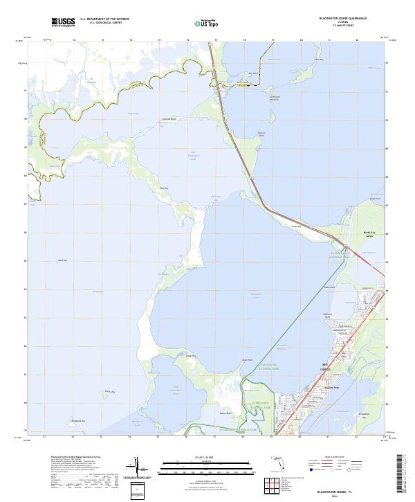
2024 Map of Blackwater Sound
USGS Topo · Published 2024About this map
Everglades National Park and the Marjory Stoneman Douglas Wilderness dominate this coastal survey, where the terrestrial mangroves of the mainland meet the northern Florida Keys. The map details the complex transition from The Everglades into Blackwater Sound and Florida Bay, showing a landscape defined by shallow passes like Long Sound Pass and Blackwater Pass. To the east, the inhabited portions of Key Largo and North Key Largo are clearly delineated, centered on the transit corridor where the Intracoastal Waterway and the Florida Keys Overseas Heritage Trl bridge the gap at Jewfish Creek.
Find a feature on this map
75 named features on this map. Tap any name to fly to it.
Don’t see what you’re looking for? This feature index may not catch every label — zoom into the map to look around manually.
Map Details
Editions of this 2024 Blackwater Sound Map
This is the sole edition of this map. No revisions or reprints were ever made.
Other maps of this area

1947 · Garden Cove
USGS Topo · 1:24,000

1947 · Rock Harbor
USGS Topo · 1:24,000

1947 · Blackwater Sound
USGS Topo · 1:24,000

1949 · Blackwater Sound
USGS Topo · 1:24,000

1949 · Rock Harbor
USGS Topo · 1:24,000

1949 · Garden Cove
USGS Topo · 1:24,000

1949 · Card Sound
USGS Topo · 1:24,000

1950 · Glades
USGS Topo · 1:24,000

1956 · Card Sound
USGS Topo · 1:24,000

1956 · Glades
USGS Topo · 1:24,000