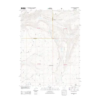
2013 Map of Blair Mountain
USGS Topo · Published 2013About this map
White River National Forest encompasses this high-altitude landscape, where the rugged topography of the White River Plateau meets the expansive Flat Tops. The terrain is defined by dramatic elevation shifts, notably from the heights of Blair Mountain and Fowler Peak down into the deep incision of South Fork Canyon. Water is a primary feature of the region, with the South Fork White River and Patterson Creek draining the highlands, while numerous alpine basins hold named waters such as Crater Lake, Mahaffey Lake, and the Elk Lakes.
Find a feature on this map
43 named features on this map. Tap any name to fly to it.
Don’t see what you’re looking for? This feature index may not catch every label — zoom into the map to look around manually.
Map Details
Editions of this 2013 Blair Mountain Map
This is the sole edition of this map. No revisions or reprints were ever made.
Other maps of this area

1906 · Grand Hogback
USGS Topo · 1:125,000

1910 · Grand Hogback
USGS Topo · 1:125,000

1927 · Glenwood Springs
USGS Topo · 1:125,000

1930 · Glenwood Springs
USGS Topo · 1:125,000

1957 · Leadville
USGS Topo · 1:250,000

1959 · Leadville
USGS Topo · 1:250,000

1960 · Leadville
USGS Topo · 1:250,000

1962 · Leadville
USGS Topo · 1:250,000

1964 · Leadville
USGS Topo · 1:250,000
1966 · Meadow Creek Lake
USGS Topo · 1:24,000