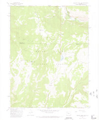
1966 Map of Meadow Creek Lake
USGS Topo · Published 1969About this map
White River National Forest defines this high-elevation landscape, where the South Fork White River carves through a deep Canyon near the county line between Rio Blanco and Garfield counties. This mid-1960s survey reveals a network of primitive access points, centered around the New Castle Buford Road and historical paths like the Ute Trail. The presence of Clark Cabin and the Meadow Creek Cow Camp suggests the enduring seasonal use of these uplands for livestock and timber management. Water remains the primary landmark in this drainage-heavy terrain, from the secluded Meadow Creek Lake to geological curiosities like Spring Cave. The topography transitions from the dramatic Clark Ridge to the broad expanse of Clinetop Mesa, providing a clear record of the backcountry infrastructure used by ranchers and outdoorsmen before modern recreational development intensified.
Find a feature on this map
31 named features on this map. Tap any name to fly to it.
Don’t see what you’re looking for? This feature index may not catch every label — zoom into the map to look around manually.
Map Details
Editions of this 1966 Meadow Creek Lake Map
3 editions found
Other maps of this area

1906 · Grand Hogback
USGS Topo · 1:125,000

1910 · Grand Hogback
USGS Topo · 1:125,000

1927 · Glenwood Springs
USGS Topo · 1:125,000

1930 · Glenwood Springs
USGS Topo · 1:125,000

1957 · Leadville
USGS Topo · 1:250,000

1959 · Leadville
USGS Topo · 1:250,000

1960 · Leadville
USGS Topo · 1:250,000

1962 · Leadville
USGS Topo · 1:250,000

1964 · Leadville
USGS Topo · 1:250,000
1966 · Rifle Falls
USGS Topo · 1:24,000