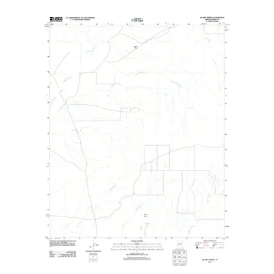
2011 Map of Blairs Spring
USGS Topo · Published 2011About this map
Blairs Spring and its surrounding network of ephemeral watercourses anchor this high-desert landscape in Navajo County. The area is defined by a series of north-flowing drainage systems, including Blairs Spring Wash, Manila Wash, and Mesa Wash, which reveal the hydrological patterns essential for life in this arid region. Man-made water infrastructure, such as Marshall Well, South Well, and the Joseph City Tank, indicates a history of livestock management and resource utilization. The terrain is marked by distinctive geological features like Jagged Rock and the prominent Spring Ridge, while Westover Spring and Joseph City Spring provide rare perennial water sources. The map also traces N Porter, a primary transport route through this sparsely populated sector of northern Arizona.
Find a feature on this map
15 named features on this map. Tap any name to fly to it.
Don’t see what you’re looking for? This feature index may not catch every label — zoom into the map to look around manually.
Map Details
Editions of this 2011 Blairs Spring Map
This is the sole edition of this map. No revisions or reprints were ever made.
Other maps of this area

1883 · Tusayan
USGS Topo · 1:250,000

1886 · Tusayan
USGS Topo · 1:250,000

1886 · Holbrook
USGS Topo · 1:250,000

1893 · Holbrook
USGS Topo · 1:250,000

1947 · Flagstaff
USGS Topo · 1:250,000

1954 · Flagstaff
USGS Topo · 1:250,000

1954 · Holbrook
USGS Topo · 1:250,000

1955 · Mal Pais Springs 3 SW
USGS Topo · 1:24,000
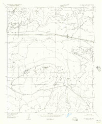
1955 · St. Joseph 2 NW
USGS Topo · 1:24,000

1955 · St. Joseph 1 NW
USGS Topo · 1:24,000