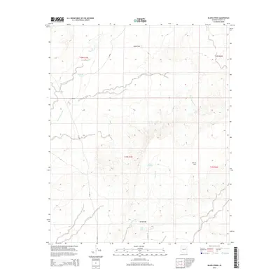
2014 Map of Blairs Spring
USGS Topo · Published 2014About this map
Blairs Spring serves as a focal point for water management in this arid stretch of Navajo County, reflecting the critical importance of reliable water sources for ranching and settlement. The landscape is defined by its drainage systems, including the prominent Blairs Spring Wash, Cottonwood Wash, and Manila Wash, which channel seasonal flows through the high desert. Man-made interventions like the Joseph City Tank, Marshall Well, and South Well illustrate how early residents adapted to the environment. The terrain rises to distinct formations such as Jagged Rock and the high plateau of Marcou Mesa. To the south, Spring Ridge overlooks smaller water features including Joseph Spring and Westover Spring, highlighting a concentrated area of hydrological activity. This 2014 survey documents the enduring spatial relationship between topography and the scarce water resources that dictate the footprint of human activity in northeastern Arizona.
Find a feature on this map
19 named features on this map. Tap any name to fly to it.
Don’t see what you’re looking for? This feature index may not catch every label — zoom into the map to look around manually.
Map Details
Editions of this 2014 Blairs Spring Map
This is the sole edition of this map. No revisions or reprints were ever made.
Other maps of this area

1883 · Tusayan
USGS Topo · 1:250,000

1886 · Tusayan
USGS Topo · 1:250,000

1886 · Holbrook
USGS Topo · 1:250,000

1893 · Holbrook
USGS Topo · 1:250,000

1947 · Flagstaff
USGS Topo · 1:250,000

1954 · Flagstaff
USGS Topo · 1:250,000

1954 · Holbrook
USGS Topo · 1:250,000

1955 · Mal Pais Springs 3 SW
USGS Topo · 1:24,000
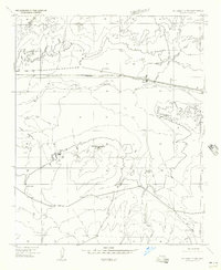
1955 · St. Joseph 2 NW
USGS Topo · 1:24,000

1955 · St. Joseph 1 NW
USGS Topo · 1:24,000