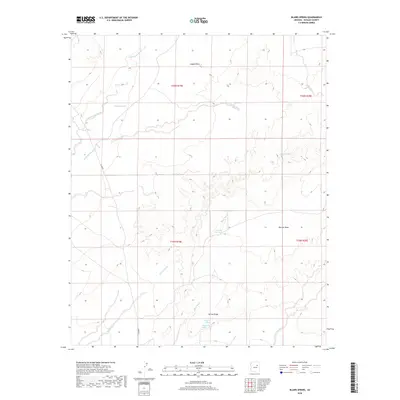
2018 Map of Blairs Spring
USGS Topo · Published 2018About this map
Blairs Spring and Blairs Spring Wash characterize this arid landscape in Navajo County, where water sources are vital landmarks across the high desert terrain. This 2018 survey documents a sparse but critical network of springs and wells, including Westover Spring, Joseph City Spring, and Marshall Well, which have long supported ranching and transit in this region. The map captures a topography defined by distinct geological formations such as Jagged Rock and the prominent Marcou Mesa to the east.
Find a feature on this map
20 named features on this map. Tap any name to fly to it.
Don’t see what you’re looking for? This feature index may not catch every label — zoom into the map to look around manually.
Map Details
Editions of this 2018 Blairs Spring Map
This is the sole edition of this map. No revisions or reprints were ever made.
Other maps of this area

1883 · Tusayan
USGS Topo · 1:250,000

1886 · Tusayan
USGS Topo · 1:250,000

1886 · Holbrook
USGS Topo · 1:250,000

1893 · Holbrook
USGS Topo · 1:250,000

1947 · Flagstaff
USGS Topo · 1:250,000

1954 · Flagstaff
USGS Topo · 1:250,000

1954 · Holbrook
USGS Topo · 1:250,000

1955 · Mal Pais Springs 3 SW
USGS Topo · 1:24,000
1955 · St. Joseph 2 NW
USGS Topo · 1:24,000

1955 · St. Joseph 1 NW
USGS Topo · 1:24,000