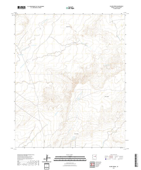
2021 Map of Blairs Spring
USGS Topo · Published 2021About this map
Blairs Spring and Joseph City Spring serve as critical water points in this arid Navajo County landscape, where the survival of early ranching and travel depended on scattered seepages and man-made improvements. The terrain is defined by dramatic geological markers like the high Marcou Mesa and the prominent Jagged Rock to the north. These features provide essential orientation within a complex network of seasonal drainage channels, including Cottonwood Wash and Blairs Spring Wash. The presence of Marshall Well, South Well, and the Joseph City Tank underscores the ongoing importance of water management in the High Desert. Following Spring Ridge south, the map reveals a landscape etched by erosion, where Manila Wash and Mesa Wash intersect, illustrating the hydrologic patterns that have shaped land use in this part of Arizona for generations.
Find a feature on this map
19 named features on this map. Tap any name to fly to it.
Don’t see what you’re looking for? This feature index may not catch every label — zoom into the map to look around manually.
Map Details
Editions of this 2021 Blairs Spring Map
This is the sole edition of this map. No revisions or reprints were ever made.
Other maps of this area

1883 · Tusayan
USGS Topo · 1:250,000

1886 · Tusayan
USGS Topo · 1:250,000

1886 · Holbrook
USGS Topo · 1:250,000

1893 · Holbrook
USGS Topo · 1:250,000

1947 · Flagstaff
USGS Topo · 1:250,000

1954 · Flagstaff
USGS Topo · 1:250,000

1954 · Holbrook
USGS Topo · 1:250,000

1955 · Mal Pais Springs 3 SW
USGS Topo · 1:24,000
1955 · St. Joseph 2 NW
USGS Topo · 1:24,000

1955 · St. Joseph 1 NW
USGS Topo · 1:24,000