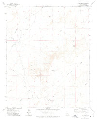
1972 Map of Blairs Spring
USGS Topo · Published 1975About this map
Marcou Mesa dominates the southern half of this landscape, rising above the various drainages that define the high desert of Navajo County. The land is marked by an intricate network of seasonal waterways, including the winding Cottonwood Wash and Billy Wash, which converge as they move toward the Little Colorado River valley just south of this quadrangle. These washes dictate the locations of historical water sources essential for livestock and settlement in this arid environment, such as Blairs Spring and Westover Spring.
Find a feature on this map
18 named features on this map. Tap any name to fly to it.
Don’t see what you’re looking for? This feature index may not catch every label — zoom into the map to look around manually.
Map Details
Editions of this 1972 Blairs Spring Map
This is the sole edition of this map. No revisions or reprints were ever made.
Other maps of this area

1883 · Tusayan
USGS Topo · 1:250,000

1886 · Tusayan
USGS Topo · 1:250,000

1886 · Holbrook
USGS Topo · 1:250,000

1893 · Holbrook
USGS Topo · 1:250,000

1947 · Flagstaff
USGS Topo · 1:250,000

1954 · Flagstaff
USGS Topo · 1:250,000

1954 · Holbrook
USGS Topo · 1:250,000

1955 · Mal Pais Springs 3 SW
USGS Topo · 1:24,000
1955 · St. Joseph 2 NW
USGS Topo · 1:24,000

1955 · St. Joseph 1 NW
USGS Topo · 1:24,000