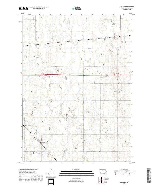
2022 Map of Blairsburg
USGS Topo · Published 2022About this map
Blairsburg and Kamrar anchor this rural Hamilton County landscape, where the agricultural grid is defined by a sophisticated network of drainage engineering. The Northwestern Line railroad cuts across the prairie, passing through the small settlement of Stonega as it links the farming communities. Water management is the primary topographical feature here, with numerous man-made channels such as Ditch Number 206, Ditch Number 166, and the Loop Br Ditch augmenting the natural course of the S Skunk River. These waterways reveal the intensive effort required to transform the Iowa wetlands into productive farmland.
Find a feature on this map
50 named features on this map. Tap any name to fly to it.
Don’t see what you’re looking for? This feature index may not catch every label — zoom into the map to look around manually.
Map Details
Editions of this 2022 Blairsburg Map
This is the sole edition of this map. No revisions or reprints were ever made.
Other maps of this area

1954 · Waterloo
USGS Topo · 1:250,000

1955 · Waterloo
USGS Topo · 1:250,000

1978 · Blairsburg
USGS Topo · 1:24,000

1978 · Woolstock
USGS Topo · 1:24,000

1978 · Ellsworth
USGS Topo · 1:24,000

1978 · Webster City
USGS Topo · 1:24,000

1978 · Sheldon Creek
USGS Topo · 1:24,000
1978 · Stanhope
USGS Topo · 1:24,000

1978 · Jewell
USGS Topo · 1:24,000

1978 · Clarion SW
USGS Topo · 1:24,000