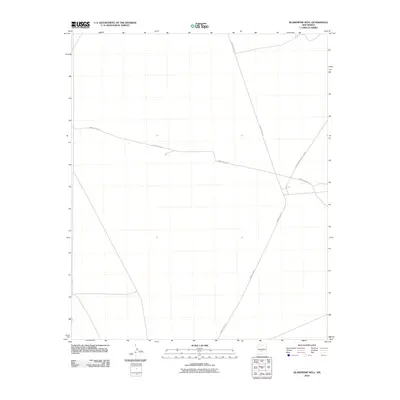
2010 Map of Blakemore Well
USGS Topo · Published 2010About this map
The White Sands Missile Range dominates this landscape in Socorro County, New Mexico, reflecting the long-standing military presence and restricted access that characterizes this high-desert region. The geography is defined largely by a network of tactical and transport corridors, most notably the intersection of Wsmr P Route 5 and Wsmr P Route 26. These designated routes provide the primary structure across the open terrain, facilitating movement within the secure range. The minimal settlement shown here is typical of active testing grounds, where infrastructure is focused on utility and logistical transit rather than civilian community development.
Find a feature on this map
3 named features on this map. Tap any name to fly to it.
Don’t see what you’re looking for? This feature index may not catch every label — zoom into the map to look around manually.
Map Details
Editions of this 2010 Blakemore Well Map
This is the sole edition of this map. No revisions or reprints were ever made.
Other maps of this area

1916 · Salinas Peak
USGS Topo · 1:125,000

1948 · Granjean Well
USGS Topo · 1:62,500

1948 · Val Verde
USGS Topo · 1:62,500

1948 · Malpais Well
USGS Topo · 1:62,500

1948 · Salinas Peak
USGS Topo · 1:62,500

1954 · Tularosa
USGS Topo · 1:250,000

1958 · Tularosa
USGS Topo · 1:250,000

1981 · Fairview Mountain
USGS Topo · 1:24,000
1981 · Greens Baber Well
USGS Topo · 1:24,000

1981 · Granjean Well
USGS Topo · 1:24,000