
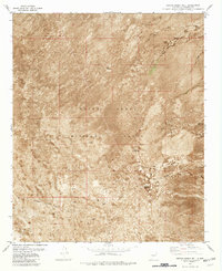
2013 Map of Blakemore Well
USGS Topo · Published 2013About this map
Jornada del Muerto occupies the central expanse of this high-desert landscape in Socorro County, representing a region defined by its aridity and historical reputation for difficult passage. The presence of Blakemore Well in the northern portion of the quadrangle highlights the critical importance of water sources in this stretch of the Chihuahuan Desert. The terrain is largely dominated by subtle contour changes across the basin floor, where movement is facilitated primarily by the WSMR P Route 26. This corridor provides a modern connection through an area that was once a notorious segment of the Camino Real de Tierra Adentro, though here it is marked by the infrastructure of the White Sands Missile Range. The landscape remains largely undeveloped, preserving the character of the desert as it appeared in the early 21st century.
Find a feature on this map
7 named features on this map. Tap any name to fly to it.
Don’t see what you’re looking for? This feature index may not catch every label — zoom into the map to look around manually.
Map Details
Editions of this 2013 Blakemore Well Map
This is the sole edition of this map. No revisions or reprints were ever made.
Other maps of this area

1916 · Salinas Peak
USGS Topo · 1:125,000

1948 · Granjean Well
USGS Topo · 1:62,500

1948 · Val Verde
USGS Topo · 1:62,500

1948 · Malpais Well
USGS Topo · 1:62,500

1948 · Salinas Peak
USGS Topo · 1:62,500

1954 · Tularosa
USGS Topo · 1:250,000

1958 · Tularosa
USGS Topo · 1:250,000

1981 · Fairview Mountain
USGS Topo · 1:24,000
1981 · Greens Baber Well
USGS Topo · 1:24,000

1981 · Granjean Well
USGS Topo · 1:24,000