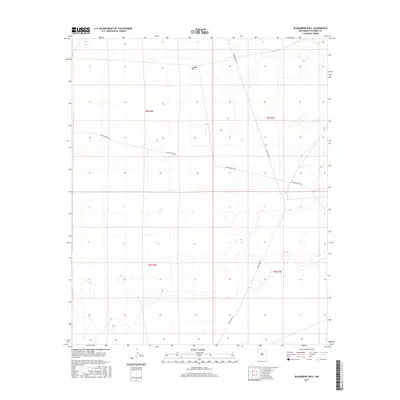
2017 Map of Blakemore Well
USGS Topo · Published 2017About this map
Blakemore Well serves as the namesake landmark for this stretch of desert landscape within the T8S and T9S townships of Socorro County. The terrain is defined by a network of controlled access roads, including WSMR P Route 5 and WSMR P Route 26, which cut through the arid basins of the White Sands Missile Range. This 2017 survey reflects the contemporary logistical and utility footprint of the region, where infrastructure is sparse and centered on water sources and military transit routes. The land is organized across the t8s r2e, t8s r3e, t9s r2e, and t9s r3e land survey boundaries, illustrating the modern management of this high-desert territory.
Find a feature on this map
7 named features on this map. Tap any name to fly to it.
Don’t see what you’re looking for? This feature index may not catch every label — zoom into the map to look around manually.
Map Details
Editions of this 2017 Blakemore Well Map
This is the sole edition of this map. No revisions or reprints were ever made.
Other maps of this area

1916 · Salinas Peak
USGS Topo · 1:125,000

1948 · Granjean Well
USGS Topo · 1:62,500

1948 · Val Verde
USGS Topo · 1:62,500

1948 · Malpais Well
USGS Topo · 1:62,500

1948 · Salinas Peak
USGS Topo · 1:62,500

1954 · Tularosa
USGS Topo · 1:250,000

1958 · Tularosa
USGS Topo · 1:250,000

1981 · Fairview Mountain
USGS Topo · 1:24,000
1981 · Greens Baber Well
USGS Topo · 1:24,000

1981 · Granjean Well
USGS Topo · 1:24,000