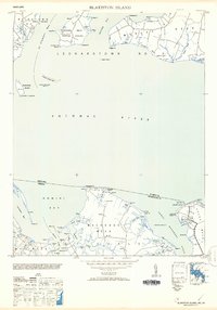
1953 Map of Blakiston Island
USGS Topo · Published 1953About this map
The wide reach of the Potomac River separates the shores of St. Mary's County and Westmoreland County, defining a landscape of deep tidal inlets and finger-like peninsulas. On the Maryland side, the Newtown Neck Proving Ground and Miles Town Neck overlook St Clement Bay, while the Blakiston I Lighthouse stands watch on Blakiston Island. To the south in Virginia, the community of Coles Point sits near the mouth of Machodoc Creek. The map documents a maritime-oriented geography where navigation aids like the Huggins Point Lt and Barnes Pt Shoal Lt are essential for navigating the complex shoreline. Land use is scattered, with small clusters like Feddle and landmarks such as Boundary Mon 20 marking the transition from the river banks to the interior of Machodoc Neck.
Find a feature on this map
86 named features on this map. Tap any name to fly to it.
Don’t see what you’re looking for? This feature index may not catch every label — zoom into the map to look around manually.
Map Details
Editions of this 1953 Blakiston Island Map
2 editions found
Other maps of this area

1892 · Leonardtown
USGS Topo · 1:62,500

1892 · Piney Point
USGS Topo · 1:62,500

1892 · Montross
USGS Topo · 1:62,500

1894 · Wicomico
USGS Topo · 1:62,500

1894 · Piney Point
USGS Topo · 1:62,500

1895 · Wicomico
USGS Topo · 1:62,500

1895 · Leonardtown
USGS Topo · 1:62,500

1895 · Nomini
USGS Topo · 1:125,000

1895 · Piney Point
USGS Topo · 1:62,500

1895 · Montross
USGS Topo · 1:62,500