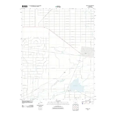
2010 Map of Blanca
USGS Topo · Published 2010About this map
Blanca serves as the primary hub of this high-altitude basin, where a systematic grid of county roads meets the engineered water systems essential for agriculture. The town's layout is mirrored by the smaller settlement of McClintock to the south, both positioned near the vital corridor of US Highway 160. Water management is the defining characteristic of this landscape, evidenced by the convergence of Trinchera Creek and Sangre de Cristo Creek into the large expanse of Smith Reservoir. The presence of the Smith Dam and several irrigation channels, including the Newton Ditch and Garland Ditch, underscores the valley's reliance on controlled snowmelt. To the south, the Basaltic Hills provide a distinct geological contrast to the flat, subdivided plains of the San Luis Valley. Aviation history is represented by the Blanca Airport, located centrally among the strictly oriented sections and farm tracks.
Find a feature on this map
81 named features on this map. Tap any name to fly to it.
Don’t see what you’re looking for? This feature index may not catch every label — zoom into the map to look around manually.
Map Details
Editions of this 2010 Blanca Map
This is the sole edition of this map. No revisions or reprints were ever made.
Other maps of this area

1889 · Huerfano Park
USGS Topo · 1:125,000

1892 · Huerfano Park
USGS Topo · 1:125,000

1954 · Trinidad
USGS Topo · 1:250,000

1955 · Trinidad
USGS Topo · 1:250,000

1958 · Trinidad
USGS Topo · 1:250,000

1959 · Trinidad
USGS Topo · 1:250,000

1965 · Blanca
USGS Topo · 1:24,000

1965 · Baldy
USGS Topo · 1:24,000

1965 · Lasauses
USGS Topo · 1:24,000

1965 · Blanca SE
USGS Topo · 1:24,000