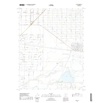
2019 Map of Blanca
USGS Topo · Published 2019About this map
Blanca sits at the intersection of US Highway 160 and the Alamosa and Costilla County line, serving as a hub for the surrounding agricultural basin. The landscape is defined by an intricate network of water management, with the Newton Ditch and Garland Ditch redirecting flows toward the expansive Smith Reservoir. Several waterways including Trinchera Cr and Sangre de Cristo Cr converge south of the settlement, highlighting the importance of irrigation in this high-altitude valley. Near the town, the Blanca Airport and various rural routes like Co RD H H and Co RD 14 connect the residential grid to the broader region. The map also records numerous local road names such as Boulder Rd and Valdez Rd, providing valuable points of reference for those tracing 21st-century property boundaries and land use.
Find a feature on this map
123 named features on this map. Tap any name to fly to it.
Don’t see what you’re looking for? This feature index may not catch every label — zoom into the map to look around manually.
Map Details
Editions of this 2019 Blanca Map
This is the sole edition of this map. No revisions or reprints were ever made.
Other maps of this area

1889 · Huerfano Park
USGS Topo · 1:125,000

1892 · Huerfano Park
USGS Topo · 1:125,000

1954 · Trinidad
USGS Topo · 1:250,000

1955 · Trinidad
USGS Topo · 1:250,000

1958 · Trinidad
USGS Topo · 1:250,000

1959 · Trinidad
USGS Topo · 1:250,000

1965 · Blanca
USGS Topo · 1:24,000

1965 · Baldy
USGS Topo · 1:24,000

1965 · Lasauses
USGS Topo · 1:24,000

1965 · Blanca SE
USGS Topo · 1:24,000