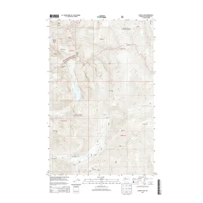
2014 Map of Blanca Lake
USGS Topo · Published 2014About this map
Blanca Lake sits at the heart of this high-elevation landscape, where the boundaries of the Mount Baker National Forest and Snoqualmie National Forest meet. The terrain is defined by dramatic peaks and glacial features, including the Columbia Glacier and the prominent Monte Cristo Peak. To the south, human activity is concentrated near water sources, evidenced by Garland Mineral Springs and Garland Hot Springs along the N Fork Skykomish River. Transportation through this steep environment is limited to significant passes and gaps such as Ida Pass, Jack Pass, and Curry Gap. The presence of the San Juan Campground and several named ridges, like W Cady Ridge, suggests a landscape primarily utilized for forest management and backcountry recreation during this era.
Find a feature on this map
44 named features on this map. Tap any name to fly to it.
Don’t see what you’re looking for? This feature index may not catch every label — zoom into the map to look around manually.
Map Details
Editions of this 2014 Blanca Lake Map
This is the sole edition of this map. No revisions or reprints were ever made.
Other maps of this area

1899 · Glacier Peak
USGS Topo · 1:125,000

1901 · Glacier Peak
USGS Topo · 1:125,000

1902 · Skykomish
USGS Topo · 1:125,000

1905 · Skykomish
USGS Topo · 1:125,000

1950 · Glacier Peak
USGS Topo · 1:62,500

1955 · Concrete
USGS Topo · 1:250,000

1957 · Wenatchee
USGS Topo · 1:250,000

1958 · Concrete
USGS Topo · 1:250,000

1962 · Concrete
USGS Topo · 1:250,000

1965 · Captain Point
USGS Topo · 1:24,000