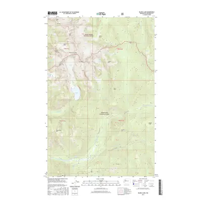
2017 Map of Blanca Lake
USGS Topo · Published 2017About this map
Mount Baker National Forest and Snoqualmie National Forest meet in this high-altitude landscape dominated by the convergence of the Cascade Range's most prominent peaks and glaciers. The turquoise waters of Blanca Lake sit below the massive Columbia Glacier, illustrating the classic glacial hydrology of the region. This 2017 survey captures a wilderness largely defined by its drainage systems, where the N Fork Skykomish River and the S Fork Sauk River originate from the surrounding slopes. The presence of Garland Hot Springs in the southwest corner suggests the geothermal activity inherent in this tectonic environment, while established routes like Nat For Dev Rd 63 provide access to interior landmarks. Peaks such as Monte Cristo Peak and Kyes Peak form a high-relief boundary between these protected forest lands, creating a snapshot of the region's preserved natural state.
Find a feature on this map
63 named features on this map. Tap any name to fly to it.
Don’t see what you’re looking for? This feature index may not catch every label — zoom into the map to look around manually.
Map Details
Editions of this 2017 Blanca Lake Map
This is the sole edition of this map. No revisions or reprints were ever made.
Other maps of this area

1899 · Glacier Peak
USGS Topo · 1:125,000

1901 · Glacier Peak
USGS Topo · 1:125,000

1902 · Skykomish
USGS Topo · 1:125,000

1905 · Skykomish
USGS Topo · 1:125,000

1950 · Glacier Peak
USGS Topo · 1:62,500

1955 · Concrete
USGS Topo · 1:250,000

1957 · Wenatchee
USGS Topo · 1:250,000

1958 · Concrete
USGS Topo · 1:250,000

1962 · Concrete
USGS Topo · 1:250,000

1965 · Captain Point
USGS Topo · 1:24,000