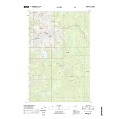
2020 Map of Blanca Lake
USGS Topo · Published 2020About this map
Monte Cristo Peak and the high alpine ridges of the Cascades dominate this topographical study of the boundary between Mount Baker National Forest and Snoqualmie National Forest. The landscape is defined by its dramatic verticality, where the Columbia Glacier feeds into Troublesome Cr and numerous high-elevation basins such as Glacier Basin and Pride Basin collect snowmelt. The North Fork Skykomish River flows through the southern portion of the quadrangle, serving as a primary drainage for the surrounding peaks. Access through this wilderness is marked by significant crossings like Jack Pass, Curry Gap, and Ida Pass, which provide the few navigable routes through the cluster of summits including Columbia Peak, Kyes Peak, and the Wilmans Peaks. Local hikers and researchers can trace the intricate network of water bodies, from the prominent Blanca Lake to smaller remote tarns like Virgin Lake, Goblin Lake, and Coney Lake.
Find a feature on this map
44 named features on this map. Tap any name to fly to it.
Don’t see what you’re looking for? This feature index may not catch every label — zoom into the map to look around manually.
Map Details
Editions of this 2020 Blanca Lake Map
This is the sole edition of this map. No revisions or reprints were ever made.
Other maps of this area

1899 · Glacier Peak
USGS Topo · 1:125,000

1901 · Glacier Peak
USGS Topo · 1:125,000

1902 · Skykomish
USGS Topo · 1:125,000

1905 · Skykomish
USGS Topo · 1:125,000

1950 · Glacier Peak
USGS Topo · 1:62,500

1955 · Concrete
USGS Topo · 1:250,000

1957 · Wenatchee
USGS Topo · 1:250,000

1958 · Concrete
USGS Topo · 1:250,000

1962 · Concrete
USGS Topo · 1:250,000

1965 · Captain Point
USGS Topo · 1:24,000