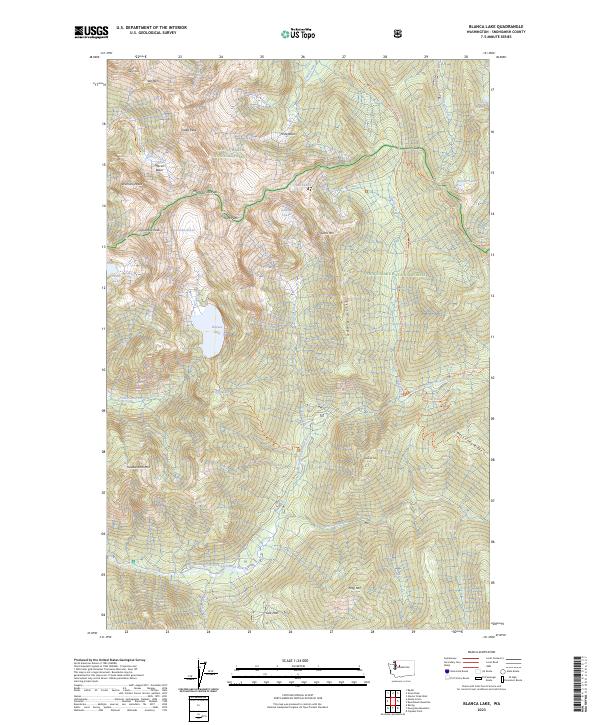
2023 Map of Blanca Lake
USGS Topo · Published 2023About this map
Columbia Glacier dominates the northwestern heights of this Snohomish County survey, feeding the icy turquoise waters of Blanca Lake. The terrain is characterized by high alpine basins and sharp dividing ridges within the Henry M Jackson Wilderness and Wild Sky Wilderness. These protected lands preserve the headwaters of several major drainages, including the North Fork Skykomish River and Troublesome Creek.
Find a feature on this map
68 named features on this map. Tap any name to fly to it.
Don’t see what you’re looking for? This feature index may not catch every label — zoom into the map to look around manually.
Map Details
Editions of this 2023 Blanca Lake Map
This is the sole edition of this map. No revisions or reprints were ever made.
Other maps of this area

1899 · Glacier Peak
USGS Topo · 1:125,000

1901 · Glacier Peak
USGS Topo · 1:125,000

1902 · Skykomish
USGS Topo · 1:125,000

1905 · Skykomish
USGS Topo · 1:125,000

1950 · Glacier Peak
USGS Topo · 1:62,500

1955 · Concrete
USGS Topo · 1:250,000

1957 · Wenatchee
USGS Topo · 1:250,000

1958 · Concrete
USGS Topo · 1:250,000

1962 · Concrete
USGS Topo · 1:250,000

1965 · Captain Point
USGS Topo · 1:24,000