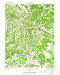
1934 Map of Bland
USGS Topo · Published 1964About this map
The Gasconade River meanders through the northern reaches of this mid-1930s landscape, flanked by deep hollows like Wildcat Hollow and high points such as Mt Sterling Hill. The southern half of the region is defined by the Chicago Rock Island and Pacific railroad corridor, which links the primary settlements of Owensville, Bland, and Belle. This era shows a dense network of rural infrastructure, with numerous family-named landmarks and community centers that served the surrounding agricultural population.
Find a feature on this map
83 named features on this map. Tap any name to fly to it.
Don’t see what you’re looking for? This feature index may not catch every label — zoom into the map to look around manually.
Map Details
Editions of this 1934 Bland Map
2 editions found
Other maps of this area

1890 · Hermann
USGS Topo · 1:125,000

1890 · Fulton
USGS Topo · 1:125,000

1903 · Sullivan
USGS Topo · 1:125,000

1934 · Linn
USGS Topo · 1:48,000

1934 · Bland
USGS Topo · 1:62,500

1934 · Redbird
USGS Topo · 1:62,500

1935 · Gerald
USGS Topo · 1:48,000

1935 · Morrison
USGS Topo · 1:48,000

1936 · Hermann
USGS Topo · 1:48,000

1937 · Bland
USGS Topo · 1:62,500