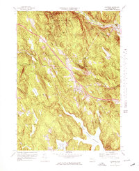
1972 Map of Blandford
USGS Topo · Published 1978About this map
Blandford and its surrounding hill towns occupy a landscape defined by significant water management and recreational infrastructure in the early 1970s. The presence of the massive Cobble Mountain Reservoir and Borden Brook Reservoir reflects the region's importance as a watershed, while the Mass Turnpike cuts a modern path across the traditional topography. The village of North Blandford and the seasonal activity at the Golf Course and Fairgrounds suggest a community balancing its agricultural roots with growing utility and leisure roles.
Find a feature on this map
52 named features on this map. Tap any name to fly to it.
Don’t see what you’re looking for? This feature index may not catch every label — zoom into the map to look around manually.
Map Details
Editions of this 1972 Blandford Map
2 editions found
Other maps of this area

1886 · Chesterfield
USGS Topo · 1:62,500

1886 · Becket
USGS Topo · 1:62,500

1887 · Granville
USGS Topo · 1:62,500

1888 · Becket
USGS Topo · 1:62,500

1888 · Sandisfield
USGS Topo · 1:62,500

1888 · Chesterfield
USGS Topo · 1:62,500

1889 · Granville
USGS Topo · 1:62,500

1893 · Granville
USGS Topo · 1:62,500

1893 · Chesterfield
USGS Topo · 1:62,500

1893 · Becket
USGS Topo · 1:62,500