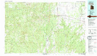
1982 Map of Blanding
USGS Topo · Published 1983About this map
The Abajo Mountains and the extensive Manti-La Sal National Forest dominate this 1982 survey of the high desert and mountain landscape of San Juan County. Settled hubs like Monticello and Blanding are connected by major routes 163, 666, and 95, while the surrounding plains are dotted with smaller communities such as Eastland, Lockerby, and Ucolo. This map documents a critical period of water management in the region, featuring several key water storage sites including Recapture Reservoir, Gordon Reservoir, and the family-named Nancy Patterson Lake.
Find a feature on this map
37 named features on this map. Tap any name to fly to it.
Don’t see what you’re looking for? This feature index may not catch every label — zoom into the map to look around manually.
Map Details
Editions of this 1982 Blanding Map
This is the sole edition of this map. No revisions or reprints were ever made.
Other maps of this area

1885 · San Rafael
USGS Topo · 1:250,000

1885 · La Sal
USGS Topo · 1:250,000

1886 · Henry Mountains
USGS Topo · 1:250,000

1886 · Abajo
USGS Topo · 1:250,000

1892 · Abajo
USGS Topo · 1:250,000

1892 · Henry Mountains
USGS Topo · 1:250,000

1893 · Abajo
USGS Topo · 1:250,000

1916 · Paradox Valley
USGS Topo · 1:125,000

1922 · Paradox Valley
USGS Topo · 1:125,000

1935 · Elk Ridge
USGS Topo · 1:96,000