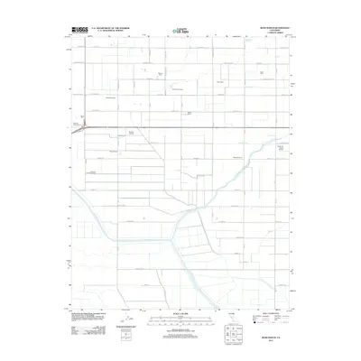
2012 Map of Bliss Ranch
USGS Topo · Published 2012About this map
Agricultural operations and water management systems define this portion of Merced County, where several family-run dairies and expansive ranches dominate the landscape. Named holdings such as Bliss Ranch, Chowchilla Ranch, and the Coelho Farms Dairy reflect the region's deep-rooted commitment to livestock and dairy production. This network of private land is supported by an intricate irrigation infrastructure including the Justin Canal, Hughes Canal, and the Ashview Canal, which divert water to sustain the valley floor.
Find a feature on this map
57 named features on this map. Tap any name to fly to it.
Don’t see what you’re looking for? This feature index may not catch every label — zoom into the map to look around manually.
Map Details
Editions of this 2012 Bliss Ranch Map
This is the sole edition of this map. No revisions or reprints were ever made.
Other maps of this area

1913 · Panoche
USGS Topo · 1:125,000

1916 · Santa Rita Bridge
USGS Topo · 1:24,000

1918 · Bliss Ranch
USGS Topo · 1:31,680

1918 · Lingard
USGS Topo · 1:31,680

1918 · Chowchilla
USGS Topo · 1:31,680

1918 · Sandy Mush
USGS Topo · 1:31,680

1919 · Plainsberg
USGS Topo · 1:31,680

1920 · Santa Rita Bridge
USGS Topo · 1:31,680

1922 · Oxalis
USGS Topo · 1:31,680

1922 · Santa Rita Bridge
USGS Topo · 1:31,680