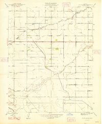
1948 Map of Bliss Ranch
USGS Topo · Published 1948About this map
Governor Earl Warren and State Engineer Edward Hyatt oversaw this postwar revision of the San Joaquin Valley landscape, where an orderly grid of section-line roads meets the meandering waters of the Chowchilla River and Ash Slough. The area is defined by large-scale agricultural operations and early resource extraction, centered around landmarks like the Bliss Ranch and the Chowchilla Ranch. Local education is anchored by the Alamo Sch and Ashview Sch, while several instances of Gas Well and scattered Windmill labels indicate the region's developing energy and water infrastructure. In the northwestern quadrant, the Red Top Ranch Airport provides a clear marker of modern transportation in a territory otherwise dominated by names such as Washington Road and Jefferson Road.
Find a feature on this map
29 named features on this map. Tap any name to fly to it.
Don’t see what you’re looking for? This feature index may not catch every label — zoom into the map to look around manually.
Map Details
Editions of this 1948 Bliss Ranch Map
2 editions found

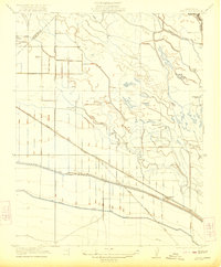
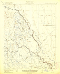
Other maps of this area

1913 · Panoche
USGS Topo · 1:125,000

1916 · Santa Rita Bridge
USGS Topo · 1:24,000

1918 · Bliss Ranch
USGS Topo · 1:31,680

1918 · Lingard
USGS Topo · 1:31,680

1918 · Chowchilla
USGS Topo · 1:31,680

1918 · Sandy Mush
USGS Topo · 1:31,680

1919 · Plainsberg
USGS Topo · 1:31,680

1920 · Santa Rita Bridge
USGS Topo · 1:31,680
1922 · Oxalis
USGS Topo · 1:31,680
1922 · Santa Rita Bridge
USGS Topo · 1:31,680