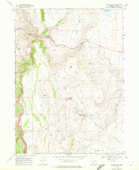
1968 Map of Blizzard Gap
USGS Topo · Published 1972About this map
Coleman Rim dominates the western edge of this High Desert landscape, where the high plateau of Lake County meets the complex drainage systems of the Great Basin. This 1968 field-checked survey highlights a remote rangeland defined by its critical water sources, featuring named points like Chukar Spring, Rosebriar Spring, and Hidden Spring that sustained early seasonal habitation. The topography is split by Greaser Canyon and the prominent pass at Blizzard Gap, providing a clear look at the navigation routes used by ranchers and early travelers through the Greaser ridge country.
Find a feature on this map
23 named features on this map. Tap any name to fly to it.
Don’t see what you’re looking for? This feature index may not catch every label — zoom into the map to look around manually.
Map Details
Editions of this 1968 Blizzard Gap Map
This is the sole edition of this map. No revisions or reprints were ever made.
Other maps of this area

1889 · Long Valley
USGS Topo · 1:250,000

1954 · Vya
USGS Topo · 1:250,000

1955 · Adel
USGS Topo · 1:250,000

1957 · Adel
USGS Topo · 1:250,000

1958 · Vya
USGS Topo · 1:250,000

1958 · Adel
USGS Topo · 1:250,000

1962 · Vya
USGS Topo · 1:250,000

1962 · Adel
USGS Topo · 1:250,000
1966 · Rye Creek
USGS Topo · 1:24,000
1966 · Little Coleman Canyon
USGS Topo · 1:24,000