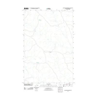
2011 Map of Blizzard Reservoir
USGS Topo · Published 2011About this map
Blizzard Reservoir and Big Snowy Reservoir anchor this 2011 topographical study of Phillips County, Montana. The landscape is defined by the drainage patterns of C K Creek and the meandering path of Sevenmile Creek to the south. A central human element in this sparsely populated region is the Nichols Coulee Camp, which sits along a network of local roads and 4WD tracks. These features indicate a landscape primarily managed for water storage and livestock grazing, with intermittent stream flows like Spring Creek providing essential seasonal water for the surrounding prairie. This digital-era map provides a precise account of the topographical elevation and hydrology that dictate movement and land use in this specific section of the Montana plains.
Find a feature on this map
6 named features on this map. Tap any name to fly to it.
Don’t see what you’re looking for? This feature index may not catch every label — zoom into the map to look around manually.
Map Details
Editions of this 2011 Blizzard Reservoir Map
This is the sole edition of this map. No revisions or reprints were ever made.
Other maps of this area

1954 · Lewistown
USGS Topo · 1:250,000

1959 · Lewistown
USGS Topo · 1:250,000

1965 · Dry Coulee
USGS Topo · 1:24,000

1965 · Dry Fork Ridge
USGS Topo · 1:24,000

1965 · Lake Reservoir
USGS Topo · 1:24,000

1971 · Robinson School
USGS Topo · 1:24,000

1971 · Bison Bone Reservoir
USGS Topo · 1:24,000

1971 · Blizzard Reservoir
USGS Topo · 1:24,000

1971 · Kepple Bottoms
USGS Topo · 1:24,000
1971 · Sagebrush Reservoir
USGS Topo · 1:24,000