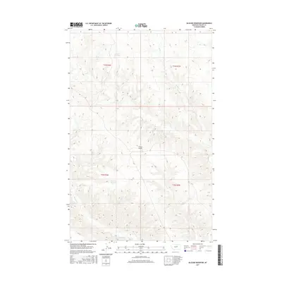
2017 Map of Blizzard Reservoir
USGS Topo · Published 2017About this map
Blizzard Reservoir and the drainage of C K Cr define this portion of Phillips County, Montana, as it appeared during a 2017 U.S. Geological Survey project. The landscape is characterized by its complex hydrography and varying terrain, featuring numerous small watercourses and the distinct geographical formation of Nichols Coulee. In the southern portion of the map, Big Snowy Reservoir serves as a secondary focal point for water management in this cattle-ranching region.
Find a feature on this map
10 named features on this map. Tap any name to fly to it.
Don’t see what you’re looking for? This feature index may not catch every label — zoom into the map to look around manually.
Map Details
Editions of this 2017 Blizzard Reservoir Map
This is the sole edition of this map. No revisions or reprints were ever made.
Other maps of this area

1954 · Lewistown
USGS Topo · 1:250,000

1959 · Lewistown
USGS Topo · 1:250,000

1965 · Dry Coulee
USGS Topo · 1:24,000

1965 · Dry Fork Ridge
USGS Topo · 1:24,000

1965 · Lake Reservoir
USGS Topo · 1:24,000

1971 · Robinson School
USGS Topo · 1:24,000

1971 · Bison Bone Reservoir
USGS Topo · 1:24,000

1971 · Blizzard Reservoir
USGS Topo · 1:24,000

1971 · Kepple Bottoms
USGS Topo · 1:24,000
1971 · Sagebrush Reservoir
USGS Topo · 1:24,000