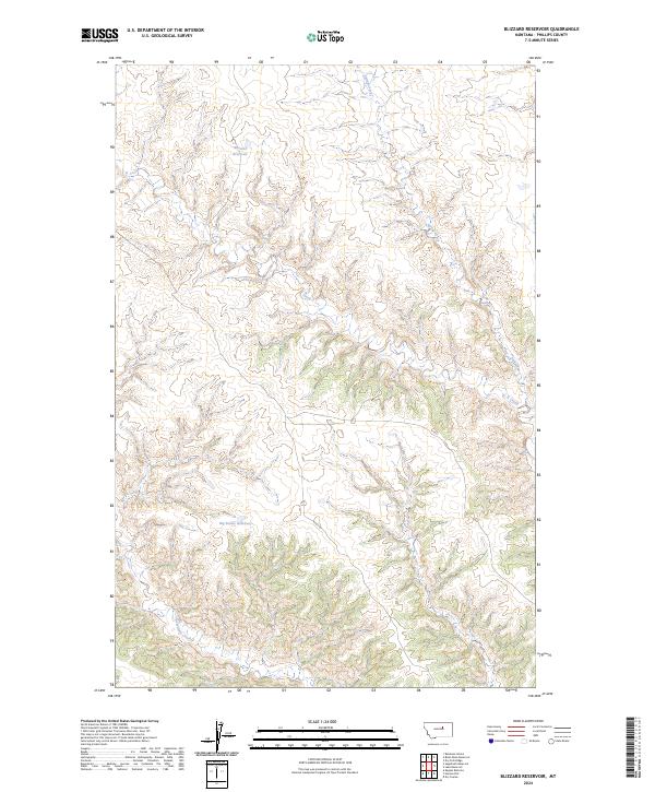
2024 Map of Blizzard Reservoir
USGS Topo · Published 2024About this map
The Charles M Russell National Wildlife Refuge dominates the southern half of this landscape, representing a significant protected tract of Phillips County. The terrain is defined by a dense network of coulees and drainages that feed into seasonal water sources like Sevenmile Creek and C K Creek. Water management in this arid environment is evident through the placement of Blizzard Reservoir in the north and Big Snowy Reservoir further south, both situated to capture runoff from the surrounding breaks. This 2024 survey illustrates the persistence of the Public Land Survey System, with township and range lines like t23n r26e and t23n r27e providing the primary human-imposed structure over a geography largely shaped by natural erosion patterns and riparian corridors like Spring Creek.
Find a feature on this map
10 named features on this map. Tap any name to fly to it.
Don’t see what you’re looking for? This feature index may not catch every label — zoom into the map to look around manually.
Map Details
Editions of this 2024 Blizzard Reservoir Map
This is the sole edition of this map. No revisions or reprints were ever made.
Other maps of this area

1954 · Lewistown
USGS Topo · 1:250,000

1959 · Lewistown
USGS Topo · 1:250,000

1965 · Dry Coulee
USGS Topo · 1:24,000

1965 · Dry Fork Ridge
USGS Topo · 1:24,000

1965 · Lake Reservoir
USGS Topo · 1:24,000

1971 · Robinson School
USGS Topo · 1:24,000

1971 · Bison Bone Reservoir
USGS Topo · 1:24,000

1971 · Blizzard Reservoir
USGS Topo · 1:24,000

1971 · Kepple Bottoms
USGS Topo · 1:24,000
1971 · Sagebrush Reservoir
USGS Topo · 1:24,000