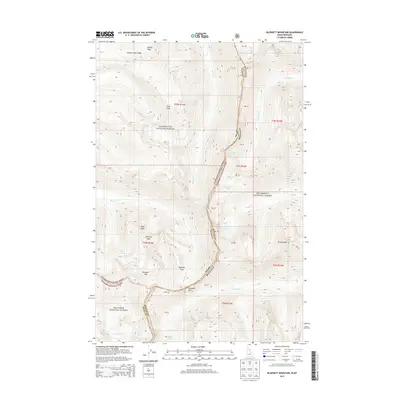
2013 Map of Blodgett Mountain
USGS Topo · Published 2013About this map
Bitterroot National Forest and its high-elevation sister forests meet along the jagged border of Idaho and Montana in this 2013 survey. The terrain is dominated by a succession of granite summits, including Blodgett Mountain and Shattuck Mountain, where glacial activity has carved deep cirques now filled by alpine water bodies. The hydrological pattern is defined by east-flowing drainages like Mill Creek and Blodgett Creek, which descend from the crest toward the Bitterroot Valley. High-altitude crossings like Blodgett Pass provide the primary transit points through this wilderness landscape. This survey documents the intersection of the Clearwater, Nez Perce, and Bitterroot forests, reflecting the complex management of this contiguous mountain wilderness. Small, isolated lakes such as Lockwood Lake and Frog Lake dot the basins below Frog Peak, illustrating the remote character of the Bitterroot Range at the start of the twenty-first century.
Find a feature on this map
35 named features on this map. Tap any name to fly to it.
Don’t see what you’re looking for? This feature index may not catch every label — zoom into the map to look around manually.
Map Details
Editions of this 2013 Blodgett Mountain Map
This is the sole edition of this map. No revisions or reprints were ever made.
Other maps of this area

1901 · Hamilton
USGS Topo · 1:125,000

1911 · Lolo
USGS Topo · 1:250,000

1913 · Lolo
USGS Topo · 1:250,000

1956 · Hamilton
USGS Topo · 1:250,000

1959 · Hamilton
USGS Topo · 1:250,000

1960 · Hamilton
USGS Topo · 1:250,000

1964 · Hamilton
USGS Topo · 1:250,000

1964 · Tenmile Lake
USGS Topo · 1:24,000

1964 · Ward Mountain
USGS Topo · 1:24,000
1966 · Blodgett Mtn
USGS Topo · 1:24,000