
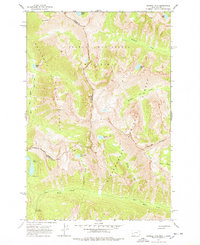
1964 Map of Tenmile Lake
USGS Topo · Published 1968About this map
The high alpine crest of the Bitterroot Mountains serves as the primary character of this 1964 survey, defining the state boundary between Idaho and Montana. This high-altitude landscape is part of the Selway-Bitterroot Wilderness, where the Nez Perce National Forest to the west meets the Bitterroot National Forest to the east. Remote water bodies like Tenmile Lake, Twelvemile Lake, and Blodgett Lake are tucked into glacial basins beneath steep ridges. Evidence of significant geological activity is visible through labels for the Ohio Slide and Poverty Slide near the Twelvemile Creek drainage. Human infrastructure is limited to the Lost Horse Guard Station, a Campground, and a high-elevation Pack Trail that follows the Moose Creek drainage, illustrating the primitive state of this wilderness area prior to modern development.
Find a feature on this map
27 named features on this map. Tap any name to fly to it.
Don’t see what you’re looking for? This feature index may not catch every label — zoom into the map to look around manually.
Map Details
Editions of this 1964 Tenmile Lake Map
2 editions found
Other maps of this area

1901 · Hamilton
USGS Topo · 1:125,000

1911 · Lolo
USGS Topo · 1:250,000

1913 · Lolo
USGS Topo · 1:250,000

1956 · Hamilton
USGS Topo · 1:250,000

1959 · Hamilton
USGS Topo · 1:250,000

1960 · Hamilton
USGS Topo · 1:250,000

1964 · Hamilton
USGS Topo · 1:250,000

1964 · Ward Mountain
USGS Topo · 1:24,000
1964 · El Capitan
USGS Topo · 1:24,000
1964 · Como Peaks
USGS Topo · 1:24,000