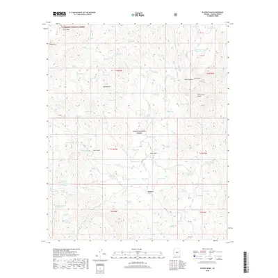
2018 Map of Bloody Basin
USGS Topo · Published 2018About this map
Bloody Basin serves as a geographic centerpiece for this high-desert landscape where the Prescott National Forest and Tonto National Forest meet. The area is defined by a network of drainage systems and high points, including the prominent Turret Peak and Rugged Mesa in the northwest. Water management is a primary feature of the mapped environment, with numerous man-made and natural sources like Roadside Tank, Turtle Tank, and Beal Tank supporting the livestock and wildlife of Yavapai County.
Find a feature on this map
96 named features on this map. Tap any name to fly to it.
Don’t see what you’re looking for? This feature index may not catch every label — zoom into the map to look around manually.
Map Details
Editions of this 2018 Bloody Basin Map
This is the sole edition of this map. No revisions or reprints were ever made.
Other maps of this area

1887 · Verde
USGS Topo · 1:250,000

1892 · Verde
USGS Topo · 1:250,000

1929 · Turret Peak
USGS Topo · 1:125,000

1933 · Turret Peak
USGS Topo · 1:125,000

1954 · Holbrook
USGS Topo · 1:250,000

1957 · Holbrook
USGS Topo · 1:250,000

1958 · Holbrook
USGS Topo · 1:250,000

1960 · Holbrook
USGS Topo · 1:250,000
1967 · Brooklyn Peak
USGS Topo · 1:24,000
1967 · Chalk Mountain
USGS Topo · 1:24,000