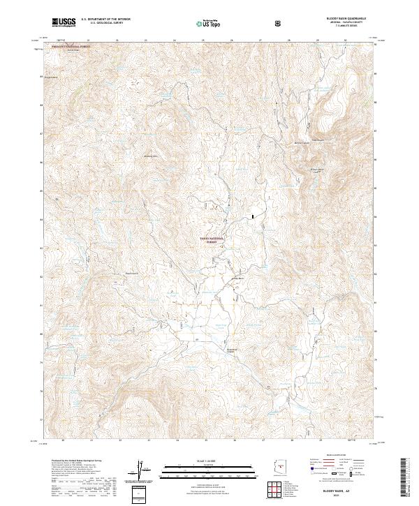
2021 Map of Bloody Basin
USGS Topo · Published 2021About this map
Bloody Basin serves as a central landmark in this remote corner of central Arizona, where the high desert meets the volcanic landforms of the Mogollon Rim transition. The landscape is defined by dramatic elevation shifts between Turret Peak and the deeply incised drainages of Red Cr and Yellow Jacket Canyon. This 2021 survey illustrates a territory managed almost entirely for public trust, split between the Prescott National Forest and the Tonto National Forest. The map reveals a sophisticated network of water management for livestock and wildlife, cataloging numerous isolated resources such as Soda Spring Number One, Soda Spring Number Two, and Beal Tank. While topographic relief like Rugged Mesa dominates the visual profile, the naming of features like Hutch Gulch and Monroe Canyon speaks to the region's enduring ranching and surveying history.
Find a feature on this map
88 named features on this map. Tap any name to fly to it.
Don’t see what you’re looking for? This feature index may not catch every label — zoom into the map to look around manually.
Map Details
Editions of this 2021 Bloody Basin Map
This is the sole edition of this map. No revisions or reprints were ever made.
Other maps of this area

1887 · Verde
USGS Topo · 1:250,000

1892 · Verde
USGS Topo · 1:250,000

1929 · Turret Peak
USGS Topo · 1:125,000

1933 · Turret Peak
USGS Topo · 1:125,000

1954 · Holbrook
USGS Topo · 1:250,000

1957 · Holbrook
USGS Topo · 1:250,000

1958 · Holbrook
USGS Topo · 1:250,000

1960 · Holbrook
USGS Topo · 1:250,000
1967 · Brooklyn Peak
USGS Topo · 1:24,000
1967 · Chalk Mountain
USGS Topo · 1:24,000