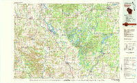
1980 Map of Bloomer
USGS Topo · Published 1980About this map
Bloomer and Rice Lake anchor this topographic survey of northwestern Wisconsin, a region defined by its dense network of waterways and glacial terrain. The Chippewa River and Flambeau River converge near Holcombe, where the Holcombe Flowage creates a massive water body that dominates the eastern half of the map. This era shows the landscape’s transition between agricultural fields and state-managed conservation lands, including the Chippewa Moraine and numerous fishery areas like the Yellow River State Fishery Area. Transportation routes are firmly established, with the Soo Line and Chicago and North Western railroads connecting the smaller dairy and mill towns. Researchers will find significant detail in the Blue Hills region and around the Dairyland Reservoir, tracing the interaction between local industry and the natural drainage of the Red Cedar River and Jump River basins.
Find a feature on this map
93 named features on this map. Tap any name to fly to it.
Don’t see what you’re looking for? This feature index may not catch every label — zoom into the map to look around manually.
Map Details
Editions of this 1980 Bloomer Map
This is the sole edition of this map. No revisions or reprints were ever made.
Other maps of this area

1934 · Elk Mound
USGS Topo · 1:62,500

1934 · Chippewa Falls
USGS Topo · 1:62,500

1936 · Chippewa Falls
USGS Topo · 1:62,500

1936 · Elk Mound
USGS Topo · 1:62,500

1940 · Menomonie
USGS Topo · 1:62,500

1942 · Menomonie
USGS Topo · 1:62,500

1944 · Exeland
USGS Topo · 1:48,000

1945 · Meteor
USGS Topo · 1:48,000

1945 · Ingram
USGS Topo · 1:48,000

1946 · Knapp
USGS Topo · 1:62,500