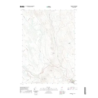
2021 Map of Bloomfield
USGS Topo · Published 2021About this map
The Nulhegan River and its numerous tributaries dominate this borderland landscape between Vermont and New Hampshire. Centered on the town of Bloomfield and neighboring North Stratford, this 2021 survey shows a region defined by complex hydrology and high-elevation terrain. Large wetland complexes like the Yellow Bogs contrast with the prominent peaks of Potash Mtn, Little Potash Mtn, and French Mtn to the south. The map documents a network of primitive access points, including the Black Branch Trl, Cold Spring Trl, and Deer Run Trl, which navigate the dense forests between the East Branch Nulhegan River and the high ground of Bloomfield Ridge. These trails and the winding Stone Dam Rd suggest a landscape managed for timber and recreation, where the natural watercourses of Mill Brook and Hibbard Brook remain the primary geographical anchors.
Find a feature on this map
38 named features on this map. Tap any name to fly to it.
Don’t see what you’re looking for? This feature index may not catch every label — zoom into the map to look around manually.
Map Details
Editions of this 2021 Bloomfield Map
This is the sole edition of this map. No revisions or reprints were ever made.
Other maps of this area

1920 · Guildhall
USGS Topo · 1:62,500

1924 · Island Pond
USGS Topo · 1:48,000

1926 · Island Pond
USGS Topo · 1:62,500

1929 · Averill
USGS Topo · 1:62,500

1931 · Guildhall
USGS Topo · 1:48,000

1933 · Guildhall
USGS Topo · 1:48,000

1937 · Guildhall
USGS Topo · 1:62,500

1950 · Lewiston
USGS Topo · 1:250,000

1951 · Burke
USGS Topo · 1:62,500

1953 · Island Pond
USGS Topo · 1:62,500