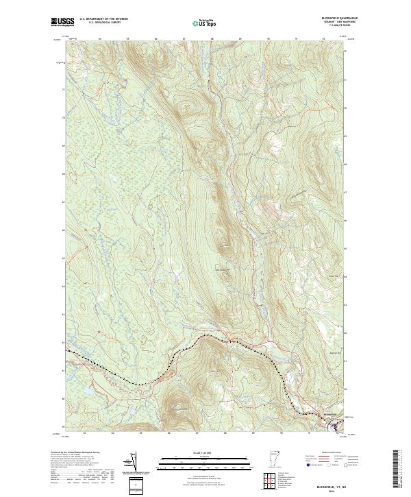
2024 Map of Bloomfield
USGS Topo · Published 2024About this map
Bloomfield serves as the focal point for this Northeastern Vermont landscape, situated at the confluence of several vital waterways in Essex County. Much of the quadrangle is occupied by the Silvio O Conte National Fish and Wildlife Refuge, a protected area characterized by the intricate drainage systems of the Nulhegan River and its branches. The terrain is defined by prominent peaks like Potash Mtn and North Notch Mtn, which frame the low-lying Yellow Bogs.
Find a feature on this map
42 named features on this map. Tap any name to fly to it.
Don’t see what you’re looking for? This feature index may not catch every label — zoom into the map to look around manually.
Map Details
Editions of this 2024 Bloomfield Map
This is the sole edition of this map. No revisions or reprints were ever made.
Other maps of this area

1920 · Guildhall
USGS Topo · 1:62,500

1924 · Island Pond
USGS Topo · 1:48,000

1926 · Island Pond
USGS Topo · 1:62,500

1929 · Averill
USGS Topo · 1:62,500

1931 · Guildhall
USGS Topo · 1:48,000

1933 · Guildhall
USGS Topo · 1:48,000

1937 · Guildhall
USGS Topo · 1:62,500

1950 · Lewiston
USGS Topo · 1:250,000

1951 · Burke
USGS Topo · 1:62,500

1953 · Island Pond
USGS Topo · 1:62,500