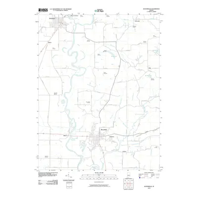
2010 Map of Bloomfield
USGS Topo · Published 2010About this map
Bloomfield serves as the central hub of this Indiana landscape, situated east of the winding White River. The river corridor is the primary geographical feature, joined by the Eel River near Worthington and Point Commerce in the north. This region is dense with family and community burial grounds, providing significant resources for genealogical research through sites like Stalcup Cemetery, Dixon Cemetery, and the Calvertville Cemetery.
Find a feature on this map
80 named features on this map. Tap any name to fly to it.
Don’t see what you’re looking for? This feature index may not catch every label — zoom into the map to look around manually.
Map Details
Editions of this 2010 Bloomfield Map
This is the sole edition of this map. No revisions or reprints were ever made.
Other maps of this area

1908 · Bloomfield
USGS Topo · 1:62,500

1938 · Coal City
USGS Topo · 1:24,000

1938 · Switz City
USGS Topo · 1:24,000

1943 · Lyons
USGS Topo · 1:24,000

1947 · Switz City
USGS Topo · 1:24,000

1948 · Coal City
USGS Topo · 1:24,000

1950 · Arney
USGS Topo · 1:24,000

1950 · Switz City
USGS Topo · 1:24,000

1951 · Bloomfield
USGS Topo · 1:24,000
1953 · Coal City
USGS Topo · 1:24,000