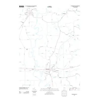
2013 Map of Bloomfield
USGS Topo · Published 2013About this map
The White River carves a winding path through this portion of Greene County, defining the local landscape with its complex oxbows and drainage systems. This 2013 survey centers on the town of Bloomfield, the county seat, which sits just east of where the river meets Lattas Cr and Dayhoff Ditch. The map illustrates a network of small settlements and neighborhood-scale clusters such as Hashtown, Elliston, and the appropriately named Furnace, located along Richland Cr.
Find a feature on this map
81 named features on this map. Tap any name to fly to it.
Don’t see what you’re looking for? This feature index may not catch every label — zoom into the map to look around manually.
Map Details
Editions of this 2013 Bloomfield Map
This is the sole edition of this map. No revisions or reprints were ever made.
Other maps of this area

1908 · Bloomfield
USGS Topo · 1:62,500

1938 · Coal City
USGS Topo · 1:24,000

1938 · Switz City
USGS Topo · 1:24,000

1943 · Lyons
USGS Topo · 1:24,000

1947 · Switz City
USGS Topo · 1:24,000

1948 · Coal City
USGS Topo · 1:24,000

1950 · Arney
USGS Topo · 1:24,000

1950 · Switz City
USGS Topo · 1:24,000

1951 · Bloomfield
USGS Topo · 1:24,000
1953 · Coal City
USGS Topo · 1:24,000