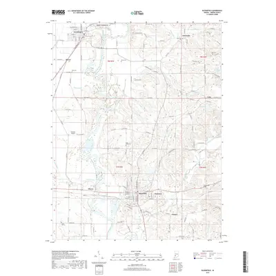
2019 Map of Bloomfield
USGS Topo · Published 2019About this map
The White River and the Eel River converge at Point Commerce, defining a landscape of low-lying floodplains and intricate drainage networks like Sloan Ditch and Dayhoff Ditch. This 2019 survey of the area around Bloomfield illustrates a region where contemporary infrastructure meets deeply rooted historical markers. The Indiana Railroad provides a central corridor through the territory, passing near Elliston and Hashtown while connecting the larger settlements. Genealogists and local historians will find significant detail in the distribution of family and community burial grounds, such as Stalcup Cem, Union Bethel Cem, and Castle Hill Cem. Landforms like Fairplay Mound and Rock Riffle suggest a landscape shaped by both ancient geological processes and human presence. To the east, the terrain becomes more varied around Persimmon Ridge, where the waters of Richland Creek and its tributaries, including Skinner Br and Ore Br, carve through the Greene County countryside.
Find a feature on this map
134 named features on this map. Tap any name to fly to it.
Don’t see what you’re looking for? This feature index may not catch every label — zoom into the map to look around manually.
Map Details
Editions of this 2019 Bloomfield Map
This is the sole edition of this map. No revisions or reprints were ever made.
Other maps of this area

1908 · Bloomfield
USGS Topo · 1:62,500

1938 · Coal City
USGS Topo · 1:24,000

1938 · Switz City
USGS Topo · 1:24,000

1943 · Lyons
USGS Topo · 1:24,000

1947 · Switz City
USGS Topo · 1:24,000

1948 · Coal City
USGS Topo · 1:24,000

1950 · Arney
USGS Topo · 1:24,000

1950 · Switz City
USGS Topo · 1:24,000

1951 · Bloomfield
USGS Topo · 1:24,000
1953 · Coal City
USGS Topo · 1:24,000