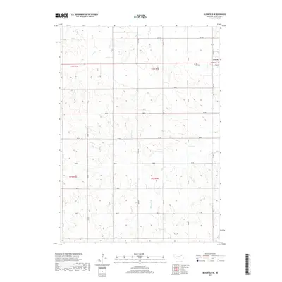
2017 Map of Bloomfield NE
USGS Topo · Published 2017About this map
Crofton anchors the northeastern corner of this rural Knox County landscape, where the residential grid meets the section lines of the surrounding countryside. The terrain is defined by the drainage patterns of Beaver Cr in the north and W Bow Cr in the southeast, which carve into the rolling Nebraska plains. Genealogists will find particular value in the documentation of local burial sites, including Saint Rose Cem just south of the Crofton outskirts and the more secluded Swede Cem situated to the west. A dense network of section-line roads, such as 891st Rd and 883rd Rd, provides a clear view of the agricultural land divisions and farmstead placements that have structured this region for generations.
Find a feature on this map
20 named features on this map. Tap any name to fly to it.
Don’t see what you’re looking for? This feature index may not catch every label — zoom into the map to look around manually.
Map Details
Editions of this 2017 Bloomfield NE Map
This is the sole edition of this map. No revisions or reprints were ever made.
Other maps of this area

1955 · Sioux City
USGS Topo · 1:250,000

1958 · Sioux City
USGS Topo · 1:250,000

1959 · Sioux City
USGS Topo · 1:250,000

1968 · Tabor SE
USGS Topo · 1:24,000

1968 · Bloomfield NE
USGS Topo · 1:24,000

1968 · Hartington SW
USGS Topo · 1:24,000

1968 · Gavins Point Dam
USGS Topo · 1:24,000

1968 · Bloomfield SE
USGS Topo · 1:24,000

1968 · Crofton
USGS Topo · 1:24,000

1974 · Lindy
USGS Topo · 1:24,000