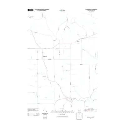
2013 Map of Bloomington
USGS Topo · Published 2013About this map
Bloomington and Patch Grove anchor this agricultural landscape in Grant County, where the topography is defined by the high ground of Military Ridge and Campbell Ridge. The map illustrates a contemporary rural environment characterized by named family farmsteads including Willowbrook Farm, Moravits Farm, and Maryline Farm, reflecting the deep-rooted dairy and agricultural heritage of Southwest Wisconsin. The drainage pattern is complex, with several watercourses like Blake Fork, Sandy Cr, and Rattlesnake Cr carving through the terrain. The network of local roads, such as Hicklin Hollow Rd and Dark Hollow Rd, follows the natural contours of the coulee country. Significant transportation corridors including Us-18, Wi-35, and Wi-133 intersect here, linking these small communities to the broader Driftless Area.
Find a feature on this map
69 named features on this map. Tap any name to fly to it.
Don’t see what you’re looking for? This feature index may not catch every label — zoom into the map to look around manually.
Map Details
Editions of this 2013 Bloomington Map
This is the sole edition of this map. No revisions or reprints were ever made.
Other maps of this area

1900 · Lancaster
USGS Topo · 1:125,000

1902 · Elkader
USGS Topo · 1:125,000

1903 · Waukon
USGS Topo · 1:125,000

1904 · Lancaster
USGS Topo · 1:125,000

1908 · Lancaster
USGS Topo · 1:125,000

1926 · Wauzeka
USGS Topo · 1:62,500

1929 · Prairie Du Chien
USGS Topo · 1:62,500

1932 · Prairie Du Chien
USGS Topo · 1:62,500

1958 · La Crosse
USGS Topo · 1:250,000

1959 · Dubuque
USGS Topo · 1:250,000