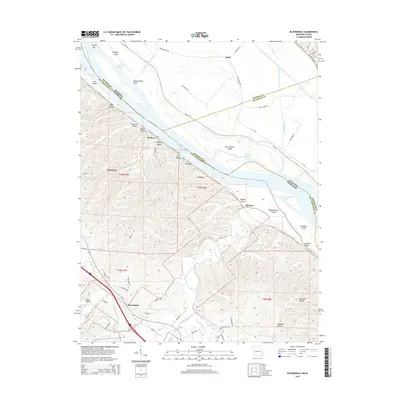
2015 Map of Bloomsdale
USGS Topo · Published 2015About this map
The Mississippi River creates a complex borderland between Missouri and Illinois here, where shifts in the river's course have left a legacy of islands and side channels. Significant landforms like Fort Chartres Island, Establishment Island, and Lee Island are separated from the mainland by chutes such as Salt Lake Chute and Establishment Chute. This riverine environment is mirrored by a landscape of deep ravines on the Missouri side, including Wolf Hollow and Brickeys Hollow, which drain toward the river through intricate creek systems.
Find a feature on this map
69 named features on this map. Tap any name to fly to it.
Don’t see what you’re looking for? This feature index may not catch every label — zoom into the map to look around manually.
Map Details
Editions of this 2015 Bloomsdale Map
This is the sole edition of this map. No revisions or reprints were ever made.
Other maps of this area

1904 · Farmington
USGS Topo · 1:62,500

1906 · Farmington
USGS Topo · 1:62,500

1907 · Weingarten
USGS Topo · 1:62,500

1909 · Weingarten
USGS Topo · 1:62,500

1915 · Renault
USGS Topo · 1:62,500

1915 · Crystal City
USGS Topo · 1:62,500

1940 · Renault
USGS Topo · 1:62,500

1949 · Saint Louis
USGS Topo · 1:250,000

1949 · Rolla
USGS Topo · 1:250,000

1949 · Crystal City
USGS Topo · 1:62,500