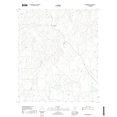
2019 Map of Blucher Mountain
USGS Topo · Published 2019About this map
Spring Creek sits at the heart of this landscape, where the rural character of San Saba County is defined by a dense network of seasonal creek beds and family-named landmarks. The terrain is marked by significant water management features, including the Lower San Saba River WS SCS Site Sixteen Reservoir and Childress Lake, which reflect the region's agricultural infrastructure. For those tracing family history, the map preserves the location of the Spring Creek Cem in the north and the Old Algerita Cem to the southwest, serving as important markers of early settlement. Aviation and ranching interests are noted via the Buzzard Creek Airstrip and Yates Field, while a web of county roads like Co RD 202 and FM 500 connects the disparate holdings across the drainages of Turkey Cr and Richland Springs Cr.
Find a feature on this map
39 named features on this map. Tap any name to fly to it.
Don’t see what you’re looking for? This feature index may not catch every label — zoom into the map to look around manually.
Map Details
Editions of this 2019 Blucher Mountain Map
This is the sole edition of this map. No revisions or reprints were ever made.
Other maps of this area

1885 · San Saba
USGS Topo · 1:125,000

1894 · San Saba
USGS Topo · 1:125,000

1925 · San Saba 2-a
USGS Topo · 1:48,000

1925 · San Saba 1-c
USGS Topo · 1:48,000

1925 · San Saba 1-b
USGS Topo · 1:48,000

1925 · San Saba 2-b
USGS Topo · 1:48,000

1928 · Goldthwaite
USGS Topo · 1:62,500

1930 · Richland Springs
USGS Topo · 1:62,500

1931 · Bend
USGS Topo · 1:62,500

1948 · Richland Springs
USGS Topo · 1:62,500