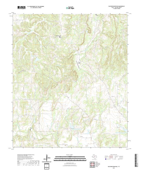
2022 Map of Blucher Mountain
USGS Topo · Published 2022About this map
Spring Creek serves as a central landmark for this portion of San Saba County, where a network of seasonal branches and creeks carves through the landscape. The settlement patterns are punctuated by small family and community burial grounds, such as Neal Cem and Spring Creek Cem, which sit alongside historic ranch roads like FM 500. Water management is a defining characteristic of the modern era here, evidenced by the Lower San Saba River WS SCS Site Sixteen Reservoir and Lower San Saba River WS SCS Site Twelve Reservoir, both part of the Soil Conservation Service's efforts to manage the watershed. Private aviation and agriculture are visible through features like Buzzard Creek Airstrip and Yates Field. The map also captures the path of Richland Springs Cr as it flows toward the Old Algerita Cem area, providing a detailed record of local geography and land use in the Texas Hill Country.
Find a feature on this map
40 named features on this map. Tap any name to fly to it.
Don’t see what you’re looking for? This feature index may not catch every label — zoom into the map to look around manually.
Map Details
Editions of this 2022 Blucher Mountain Map
This is the sole edition of this map. No revisions or reprints were ever made.
Other maps of this area

1885 · San Saba
USGS Topo · 1:125,000

1894 · San Saba
USGS Topo · 1:125,000

1925 · San Saba 2-a
USGS Topo · 1:48,000

1925 · San Saba 1-c
USGS Topo · 1:48,000

1925 · San Saba 1-b
USGS Topo · 1:48,000

1925 · San Saba 2-b
USGS Topo · 1:48,000

1928 · Goldthwaite
USGS Topo · 1:62,500

1930 · Richland Springs
USGS Topo · 1:62,500

1931 · Bend
USGS Topo · 1:62,500

1948 · Richland Springs
USGS Topo · 1:62,500