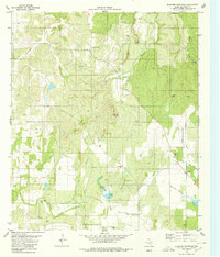
1980 Map of Blucher Mountain
USGS Topo · Published 1980About this map
Blucher Mountain rises above a landscape defined by seasonal watercourses and small rural gathering points in this corner of San Saba County. The terrain is etched by the meandering Richland Springs Creek and its many tributaries, including Bazzard Branch and Merriman Branch. Small communities and family landmarks are scattered across the quadrangle, with Bethel and Fairview serving as local anchors. For genealogists and local historians, several burial sites are recorded, such as Old Algerita Cem, Neal Cem, and Spring Creek Cem. The survey also documents the area's physical development, noting numerous Gravel Pits and various wells, such as the Flowing Well near the northern reaches of the China Creek settlement. This documentation provides a clear view of the ranching and resource-based economy that shaped this part of Central Texas during the late 1970s.
Find a feature on this map
23 named features on this map. Tap any name to fly to it.
Don’t see what you’re looking for? This feature index may not catch every label — zoom into the map to look around manually.
Map Details
Editions of this 1980 Blucher Mountain Map
This is the sole edition of this map. No revisions or reprints were ever made.
Other maps of this area

1885 · San Saba
USGS Topo · 1:125,000

1894 · San Saba
USGS Topo · 1:125,000

1925 · San Saba 2-a
USGS Topo · 1:48,000

1925 · San Saba 1-c
USGS Topo · 1:48,000

1925 · San Saba 1-b
USGS Topo · 1:48,000

1925 · San Saba 2-b
USGS Topo · 1:48,000

1928 · Goldthwaite
USGS Topo · 1:62,500

1930 · Richland Springs
USGS Topo · 1:62,500

1931 · Bend
USGS Topo · 1:62,500

1948 · Richland Springs
USGS Topo · 1:62,500