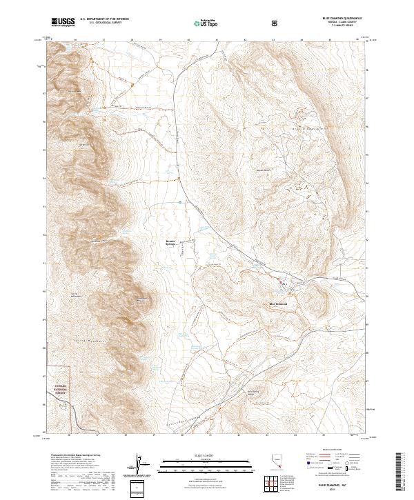
2021 Map of Blue Diamond
USGS Topo · Published 2021About this map
Bonnie Springs and the village of Blue Diamond anchor this modern-era study of the eastern edge of the Spring Mountains. The landscape is defined by its water sources and dramatic elevation changes, where features like Mormon Green Springs, Cottonwood Spring, and Lone Willow Spring appear as vital points in an arid environment. To the west, the massive Sandstone Bluffs and Rainbow Mtn overlook Sandstone Canyon within the Toiyabe National Forest.
Find a feature on this map
53 named features on this map. Tap any name to fly to it.
Don’t see what you’re looking for? This feature index may not catch every label — zoom into the map to look around manually.
Map Details
Editions of this 2021 Blue Diamond Map
This is the sole edition of this map. No revisions or reprints were ever made.
Other maps of this area

1907 · Las Vegas
USGS Topo · 1:250,000

1908 · Las Vegas
USGS Topo · 1:250,000

1910 · Ivanpah
USGS Topo · 1:250,000

1912 · Ivanpah
USGS Topo · 1:250,000

1942 · Ivanpah
USGS Topo · 1:250,000

1947 · Kingman
USGS Topo · 1:250,000

1948 · Kingman
USGS Topo · 1:250,000

1952 · Blue Diamond
USGS Topo · 1:62,500

1954 · Las Vegas
USGS Topo · 1:250,000

1954 · Kingman
USGS Topo · 1:250,000