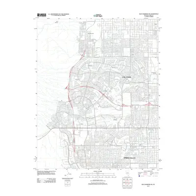
2012 Map of Blue Diamond NE
USGS Topo · Published 2012About this map
Las Vegas and the planned community of Spring Valley dominate this topographical study, showcasing the rapid suburban expansion into the desert during the early 21st century. The landscape is a dense network of residential streets and cul-de-sacs, punctuated by extensive recreational developments such as Highland Falls Golf Course and Badlands Golf Course. To the west, the grid-like residential pattern meets the natural topography of Red Rock Wash and Lone Mountain, where development transitions into steeper canyon terrain. The presence of specialized facilities like Memory Gardens and the distribution of postal hubs including Poe Post Office and Red Rock Vista Post Office provide a clear view of the institutional infrastructure required for these massive master-planned neighborhoods.
Find a feature on this map
48 named features on this map. Tap any name to fly to it.
Don’t see what you’re looking for? This feature index may not catch every label — zoom into the map to look around manually.
Map Details
Editions of this 2012 Blue Diamond NE Map
This is the sole edition of this map. No revisions or reprints were ever made.
Other maps of this area

1907 · Las Vegas
USGS Topo · 1:250,000

1908 · Las Vegas
USGS Topo · 1:250,000

1952 · Corn Creek Springs
USGS Topo · 1:62,500

1952 · Gass Peak
USGS Topo · 1:62,500

1952 · Blue Diamond
USGS Topo · 1:62,500

1952 · Las Vegas
USGS Topo · 1:62,500

1954 · Las Vegas
USGS Topo · 1:250,000

1957 · Las Vegas
USGS Topo · 1:250,000

1959 · Las Vegas
USGS Topo · 1:250,000

1962 · Las Vegas
USGS Topo · 1:250,000