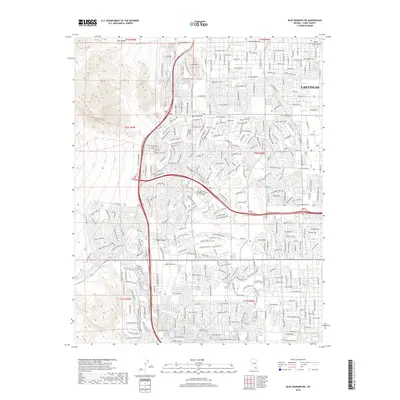
2018 Map of Blue Diamond NE
USGS Topo · Published 2018About this map
Lone Mountain stands as a prominent landmark amidst the rapid suburban expansion of western Las Vegas during the late 2010s. This survey illustrates the transformation of the Mojave Desert into a dense grid of residential streets and schools, including the Le Cordon Bleu College of Culinary Arts Las Vegas. While modern thoroughfares like W Lone Mountain Rd and W Sahara Ave dominate the landscape, older natural features like Red Rock Wash and Whitehead Springs persist along the margins of the built environment. To the north, the Bunkers Memory Gardens Cem and the rugged contours of Box Canyon provide a stark contrast to the burgeoning subdivisions that characterize this era of Nevada’s urban development.
Find a feature on this map
35 named features on this map. Tap any name to fly to it.
Don’t see what you’re looking for? This feature index may not catch every label — zoom into the map to look around manually.
Map Details
Editions of this 2018 Blue Diamond NE Map
This is the sole edition of this map. No revisions or reprints were ever made.
Other maps of this area

1907 · Las Vegas
USGS Topo · 1:250,000

1908 · Las Vegas
USGS Topo · 1:250,000

1952 · Corn Creek Springs
USGS Topo · 1:62,500

1952 · Gass Peak
USGS Topo · 1:62,500

1952 · Blue Diamond
USGS Topo · 1:62,500

1952 · Las Vegas
USGS Topo · 1:62,500

1954 · Las Vegas
USGS Topo · 1:250,000

1957 · Las Vegas
USGS Topo · 1:250,000

1959 · Las Vegas
USGS Topo · 1:250,000

1962 · Las Vegas
USGS Topo · 1:250,000