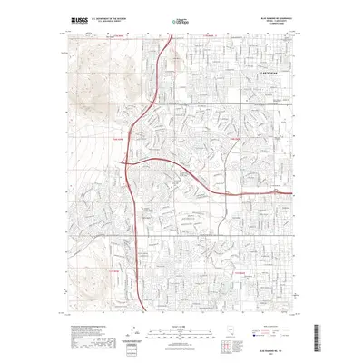
2021 Map of Blue Diamond NE
USGS Topo · Published 2021About this map
The western edge of the Las Vegas Valley is defined by a rapidly developing suburban landscape where the grid of Las Vegas meets the rising terrain of the Mojave Desert. This 2021 survey shows the densification of neighborhoods around local landmarks like Lone Mtn and the ephemeral drainage of Red Rock Wash. The map records a significant concentration of educational and medical institutions, including the UNLV School of Medicine and the College of Southern Nevada Summerlin Center, reflecting the modern expansion of the city's infrastructure. To the north, the transition from residential blocks to the desert is marked by Bunkers Memory Gardens Cem and Box Canyon, illustrating the modern interface between the built environment and the geography of the Great Basin.
Find a feature on this map
32 named features on this map. Tap any name to fly to it.
Don’t see what you’re looking for? This feature index may not catch every label — zoom into the map to look around manually.
Map Details
Editions of this 2021 Blue Diamond NE Map
This is the sole edition of this map. No revisions or reprints were ever made.
Other maps of this area

1907 · Las Vegas
USGS Topo · 1:250,000

1908 · Las Vegas
USGS Topo · 1:250,000

1952 · Corn Creek Springs
USGS Topo · 1:62,500

1952 · Gass Peak
USGS Topo · 1:62,500

1952 · Blue Diamond
USGS Topo · 1:62,500

1952 · Las Vegas
USGS Topo · 1:62,500

1954 · Las Vegas
USGS Topo · 1:250,000

1957 · Las Vegas
USGS Topo · 1:250,000

1959 · Las Vegas
USGS Topo · 1:250,000

1962 · Las Vegas
USGS Topo · 1:250,000