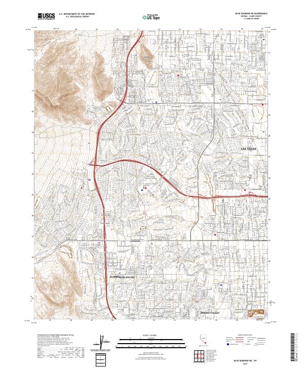
2023 Map of Blue Diamond NE
USGS Topo · Published 2023About this map
The western edge of the Las Vegas metropolitan area is documented here, showing the dense residential and institutional expansion into the Las Vegas Valley. The landscape transitions from the developed streets of Summerlin South and Spring Valley to the dramatic natural features of the Mojave Desert and Box Canyon. This 2023 survey illustrates the complex modern road network, including major thoroughfares like W Charleston Blvd and W Sahara Ave, which serve a growing cluster of educational facilities such as the College of Southern Nevada Summerlin Center and the UNLV-School of Medicine.
Find a feature on this map
31 named features on this map. Tap any name to fly to it.
Don’t see what you’re looking for? This feature index may not catch every label — zoom into the map to look around manually.
Map Details
Editions of this 2023 Blue Diamond NE Map
This is the sole edition of this map. No revisions or reprints were ever made.
Other maps of this area

1907 · Las Vegas
USGS Topo · 1:250,000

1908 · Las Vegas
USGS Topo · 1:250,000

1952 · Corn Creek Springs
USGS Topo · 1:62,500

1952 · Gass Peak
USGS Topo · 1:62,500

1952 · Blue Diamond
USGS Topo · 1:62,500

1952 · Las Vegas
USGS Topo · 1:62,500

1954 · Las Vegas
USGS Topo · 1:250,000

1957 · Las Vegas
USGS Topo · 1:250,000

1959 · Las Vegas
USGS Topo · 1:250,000

1962 · Las Vegas
USGS Topo · 1:250,000