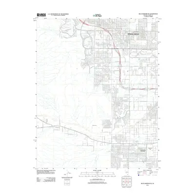
2012 Map of Blue Diamond SE
USGS Topo · Published 2012About this map
Spring Valley anchors the northern portion of this landscape, showcasing the rapid suburban expansion in Clark County during the early 21st century. The map depicts a dense residential grid transitioning into the desert terrain to the west, where the natural drainage of Tropicana Wash cuts through the development. Significant land elevation is represented by Exploration Peak, which overlooks the surrounding neighborhoods and the nearby Exploration Peak Park.
Find a feature on this map
62 named features on this map. Tap any name to fly to it.
Don’t see what you’re looking for? This feature index may not catch every label — zoom into the map to look around manually.
Map Details
Editions of this 2012 Blue Diamond SE Map
This is the sole edition of this map. No revisions or reprints were ever made.
Other maps of this area

1907 · Las Vegas
USGS Topo · 1:250,000

1908 · Las Vegas
USGS Topo · 1:250,000

1910 · Ivanpah
USGS Topo · 1:250,000

1912 · Ivanpah
USGS Topo · 1:250,000

1942 · Ivanpah
USGS Topo · 1:250,000

1947 · Kingman
USGS Topo · 1:250,000

1948 · Kingman
USGS Topo · 1:250,000

1952 · Blue Diamond
USGS Topo · 1:62,500

1952 · Las Vegas
USGS Topo · 1:62,500

1954 · Las Vegas
USGS Topo · 1:250,000